Digitizing Spatial Features: A Workflow Using ArcGIS Pro, Google Earth Pro, and ArcGIS Online
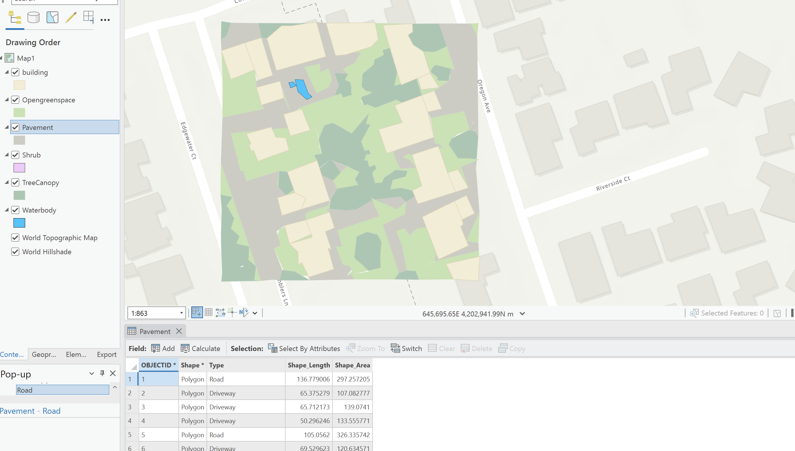
During the digitization process, I used several key tools to complete the assignment. I started with ArcGIS Pro to create and modify spatial objects, manually digitizing features like buildings, pavements, and tree canopies based on aerial imagery. Using the Create Features tool in ArcGIS Pro, I was able to draw polygons to represent these features accurately. These digitized features were integrated into a GeoDatabase to ensure both spatial accuracy and correct attribute data management.
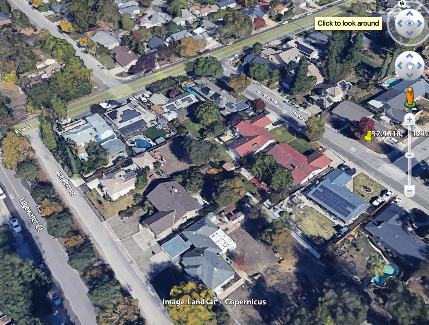
To improve the precision of the digitized polygons, I used Google Earth Pro for field verification. This allowed me to ground-truth the data by using street-level imagery to check the characteristics of features such as building types, tree heights, and vegetation coverage. By comparing the digitized polygons with real-world imagery, I could make adjustments to ensure everything aligned properly.
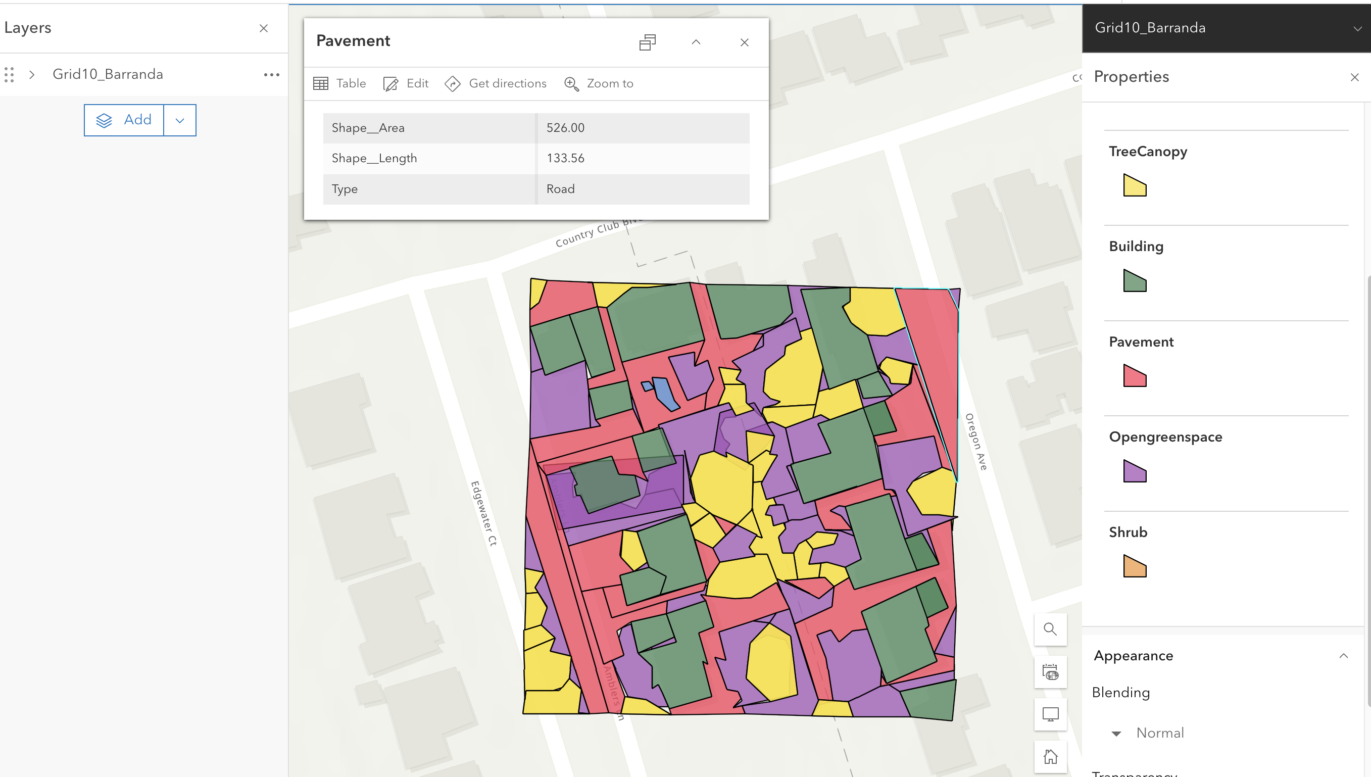
Once the digitization was complete, I uploaded my work to ArcGIS Online using the Share as Web Layer tool. This enabled me to share my digitized polygons with others and ensure the data was accessible for collaborative use. The combination of ArcGIS Pro for digitization, Google Earth Pro for validation, and ArcGIS Online for sharing made the workflow efficient and reliable.