Rattle Snake Suitability Analysis for Prescribed Fire in Alpine County
.jpg)
I worked on a rattlesnake habitat suitability analysis for Alpine County, California. The goal was to identify suitable habitats for rattlesnakes using a combination of geospatial data, and propose a prescribed fire plan to protect children from rattlesnake-infested areas near houses. The analysis involved using ArcGIS Pro tools, including Reclassify, Raster Calculator, and Buffer Analysis to determine suitable rattlesnake habitats based on elevation, slope, and distance to conserved land.
To start, I reclassified the DEM (Digital Elevation Model) based on elevation ranges, assigning scores to various elevations and slopes. I then used the Raster Calculator to combine these reclassified layers, creating a suitability map where areas with a composite score of 6 or higher were considered suitable for rattlesnakes. The Buffer Tool was used to ensure areas within 0.5 km of conserved land were prioritized for habitat analysis, as rattlesnakes are more likely to be present in these zones.
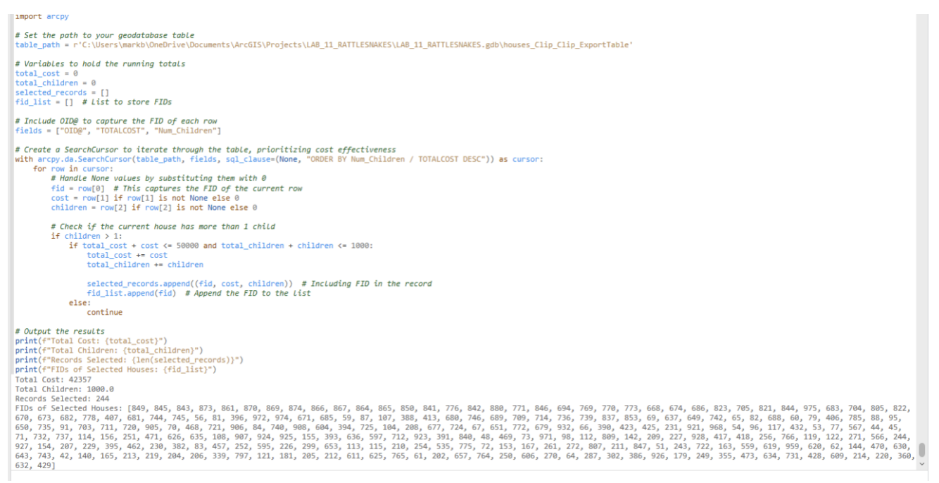
After identifying the suitable habitats, I imported the "houses" dataset and calculated the fire risk for each house using the Raster Value field. This allowed me to estimate the cost of treating each house using prescribed fire. I then joined this dataset with the "children" dataset to prioritize houses based on the number of children present. The final analysis aimed to protect 1,000 children at the least cost, using a combination of attribute joins, cost-per-child calculations, and spatial analysis to select the optimal houses for treatment.
The results of the analysis showed that the total suitable rattlesnake habitat covered 114.09 square kilometers. I identified 1,354 houses with six children and calculated that the house with the least cost per child to treat was House FID 191360, with a cost of $4 per child. Ultimately, I was able to protect 1,000 children by treating 244 houses and made a profit of $7,643 from the city's $50,000 budget.
This lab enhanced my skills in using raster data and geoprocessing tools for habitat suitability modeling, particularly in integrating multiple environmental factors to solve real-world problems.