Submerged Vegetation from pre- and post- Three Gorges Dam completion
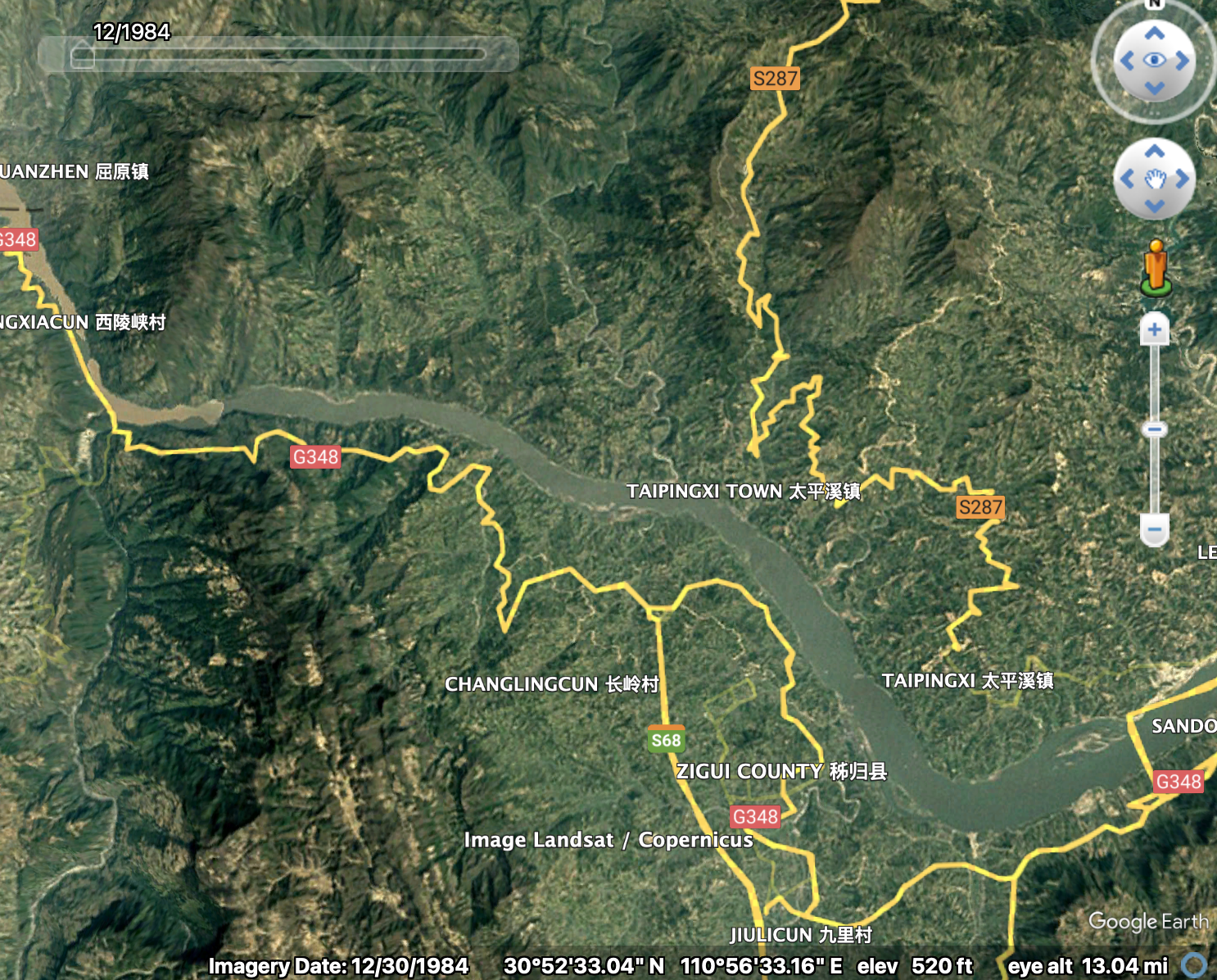
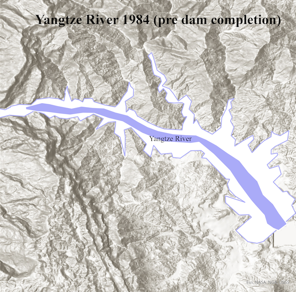
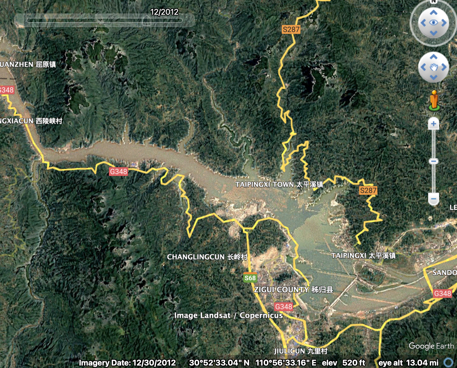
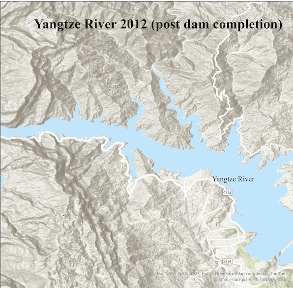
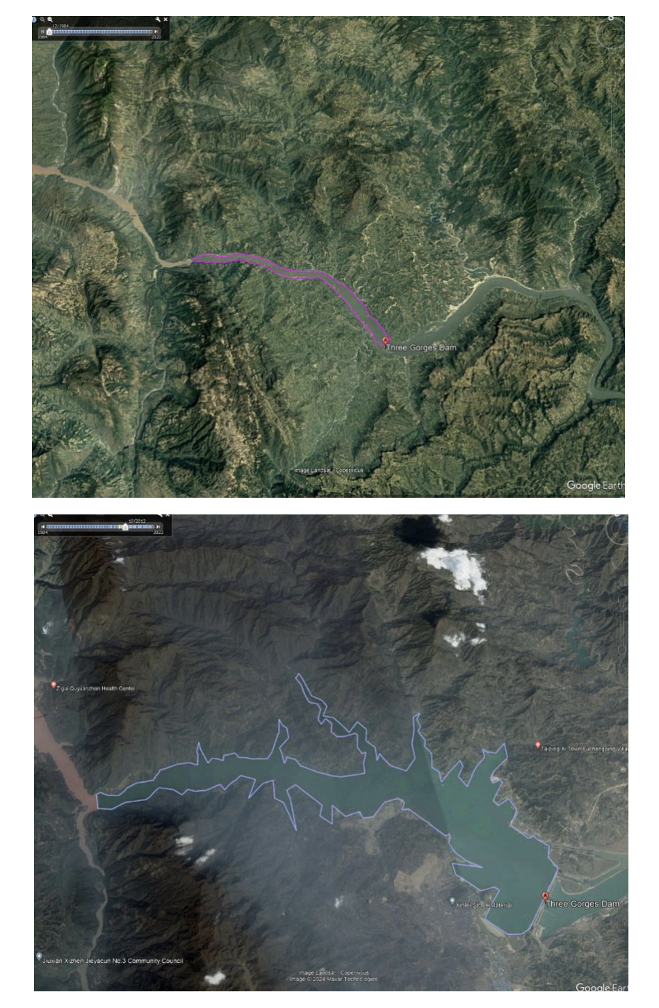
I used Google Earth Pro to extract imagery of the Three Gorges Dam from both 2012 and 1984, allowing for a temporal comparison of the landscape before and after the dam's construction. The 1984 imagery displayed the pre-dam landscape, highlighting vast areas of vegetated land and natural terrain. In contrast, the 2012 imagery revealed significant changes, including the formation of a large reservoir behind the dam, which submerged approximately 25.52 million square meters of land. This comparison illustrated the dramatic environmental transformation caused by the dam's construction.
I used several key tools in ArcGIS Pro to further analyze the data:
- The Contour Tool with 3D Analyst was employed to generate contour lines from the DEM, representing elevation levels and helping to visualize how the terrain and slopes were altered.
- The Symmetrical Difference Tool was used to determine the specific areas of vegetated land submerged by the rising reservoir.
- Aspect and Slope Tools were applied to assess the dam's surrounding terrain, showing how slope angles influenced water retention behind the dam.
Additionally, I compared the imagery's resolution and granularity, with the 2012 dataset offering much clearer detail compared to the lower resolution greenery of 1984. This temporal analysis, supported by geoprocessing tools like Zonal Statistics and Raster Calculator, helped quantify the landscape changes and visualize the topographical impact of the dam’s construction.